-
Affiliate Members
-
State Members
-
Join Us
<
>
NASTL adopted an Affiliate Membership Program to provide Valued Supporters, including public and private entities and individuals who share common interests in the NASTL's objectives, with an opportunity to formally communicate and cooperate with NASTL members. The Program offers Affiliate Members the opportunity to participate in the NASTL's annual conferences and to talk directly with other members on issues important to both.
Affiliate Membership is designed to:
- Enhance and extend NASTL, our educational missions, institutional impacts, influence and positive public image
- Develop or strengthen relationships with organizations that complement our mission
- Share intellectual & social capital
Desired Outcomes:
- Expand diversity of NASTL members and audiences
- Enhance distribution of NASTL outputs to new, relevant markets
- Augment opportunities to develop, share & evaluate information regarding land, water and other resource management policies and practices
- Help member states maximize the earnings and preserve the assets of educational trusts
|
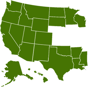
As an incident of statehood, most states west of the Mississippi River received grants of federal land (see below) to assist in the funding of public education facilities and other governmental programs. Known as school lands, trust lands or grant lands, these properties were scattered throughout the various states.
The grants by which the states were given the public lands are solemn trusts. These trusts provide that proceeds from sale or use of the land be applied specifically to education and other various purposes. Thus, these lands may not be used without compensation to the state. These lands are managed by state agencies called land offices, land commissions or land boards - collectively identified as commission. Five are headed by statewide elected officials. Most commissioners also manage lands under navigable waterways to protect resources and produce revenue. Some land commissioners also act as the fire prevention and control agency for their state. Founded as the Western States Land Commissioners Association (WSLCA) in 1949, it was in response to a need for more coordinated management of federal and state trust lands. As early as 1935, WSLCA recognized that, without establishing formal and unified relations with the Department of the Interior and other federal agencies, inconsistent and uncoordinated management of public lands would continue. |
Types of Lands Managed
State land managers deal with three primary administrative responsibilities:
- School trust lands - Most western states received grants of federal land when they became states. These land grants were given to the states to generate income for public education and other state programs. States are required by law to use school trust lands for those purposes.
- Sovereign lands - State land managers administer lands that lie below the ordinary high water mark of navigable lakes and rivers. These lands are managed for the protection of navigation, commerce, fish and wildlife habitat, aquatic beauty, public recreation, and water quality. Leases of these lands are a source of revenue.
- Fire control - Some state land managers are responsible for prevention and control of wildfire on state and private lands.
Land Grants
The General Land Ordinance of 1785 reserved section 16 in each township "for the maintenance of public schools within the said township" (see Figure below). The land grant system has not been static. As new states were added, the size of the grants to the schools was increased, grants to universities and other institutions were added and the nature of the grants was refined. For example, Montana received Sections 16 and 36 at statehood, whereas Utah received Sections 2, 16, 32, and 36 at statehood.
The word township is a measure of units north or south of the baseline, but it is also the term for each square on the grid. Each township is 6 miles by 6 miles. The township is further divided into 36 sections, each a single square mile. As you can see, sections are numbered in way that can be confusing. Section 1 is in the northeast corner of the township and the digits run in a zig-zag pattern down to the southeast corner.
For example, if this is the same township that Enumclaw occupies, then the dark square at left is Section 29, Township 20 North, Range 6 East (Sec. 29, T. 20 N., R.6.E.).
Download Federal Granted Trusts .pdf
Those interested in establishing an Affiliate or Associate relationship are encouraged to contact your State Land Commissioner, State Director or a member of the NASTL Executive Committee.
Procedures for State membership are addressed in Section 6.02 of the Association Bylaws.
Procedures for State membership are addressed in Section 6.02 of the Association Bylaws.
